Why Elevation Data Matters in Mapping, Simulation, and Analytics
How Terrain Data Improves Accuracy, Modeling, And Decision-Making
In many geospatial projects, imagery gets most of the attention. It is visual, intuitive, and easy to interpret. But behind nearly every successful mapping, simulation, modeling, and analytics workflow is a less visible yet equally critical component: elevation data.
Imagery shows you what’s there; Elevation shows you how it exists in the real world - And that difference matters.
What Is Elevation Data?
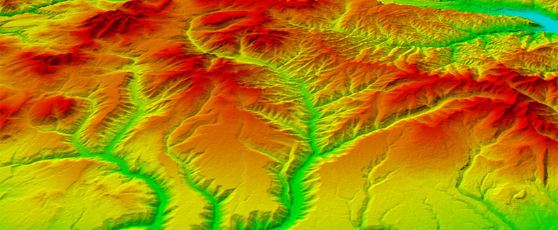
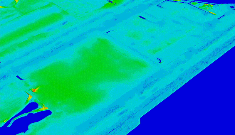
Elevation data represents the height of the Earth’s surface and the features on it. It is commonly delivered in several formats:
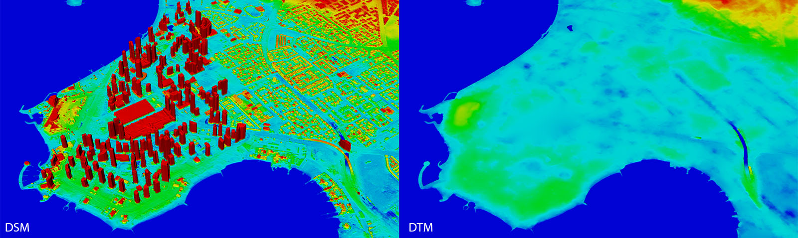
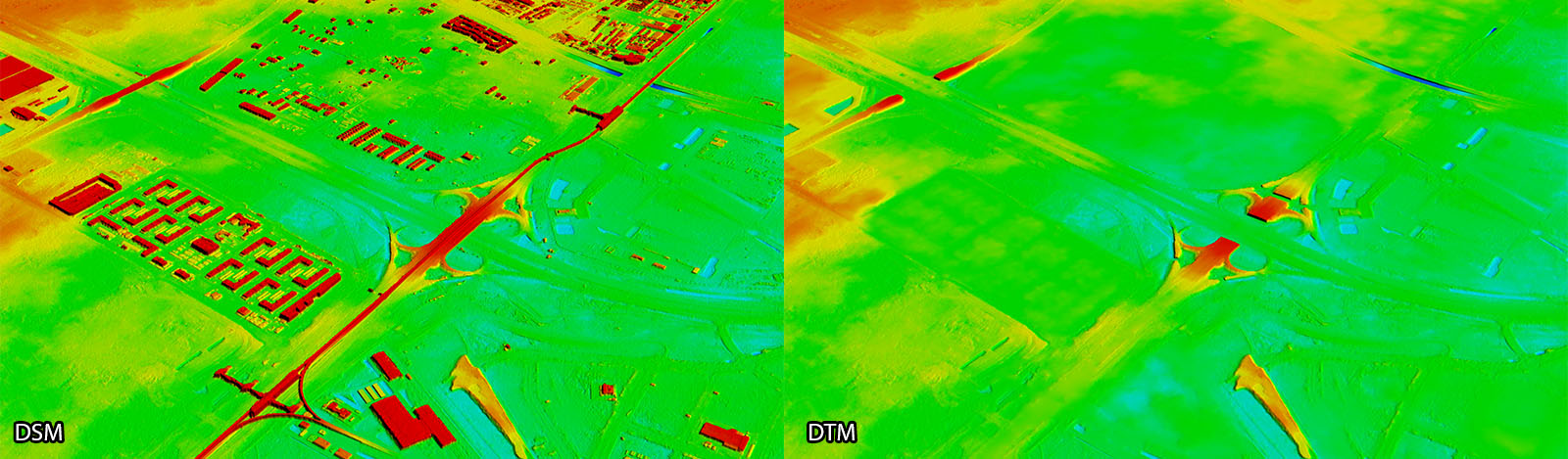
Digital Terrain Models (DTM): bare-earth ground surface
Digital Surface Models (DSM): includes buildings, vegetation, and structures
3D point clouds: often derived from LiDAR and other advanced collection methods
Each format serves a different purpose, but all provide the vertical context required for accurate geospatial analysis.
Why Elevation Matters
Turning Maps into 3D Models
Without elevation, maps are flat. With it, they become 3D representations of terrain, enabling more accurate planning, design, and simulation.
Improving Decision-Making
Elevation data plays a key role in:
- Flood and drainage analysis
- Site selection and grading
- Infrastructure design (roads, pipelines, utilities
- Environmental assessment
- Visualization and Simulation (VisSim)
Even small elevation errors can lead to costly outcomes, making data quality critical.
Enabling Geospatial Analytics
Many core analyses depend on elevation, including:
- Slope and terrain modeling
- Watershed and flow analysis
- Visibility (viewshed) studies
- Cut-and-fill calculations
Without reliable elevation data, these workflows are limited or inaccurate.
Enhancing the Value of Imagery
Imagery provides visual context, but elevation makes it operational.
Together, they support:
- Orthorectification
- Seamless Mosaics
- Accurate feature extraction
- Realistic 3D visualization
The Bottom Line
Elevation data is more than a supporting layer - it is a foundation for modern geospatial workflows.
As projects grow in scale and complexity, having access to accurate, high-quality elevation data becomes essential for delivering reliable results.
Final Thought
If imagery shows you the world, elevation explains it in three-dimensional space.
Get Started with CartaVue
IIf your organization is evaluating elevation data for your projects, CartaVue can help identify the right solution based on your operational needs.
Contact us at sales@cartavue.com or submit the Contact Sales form to schedule a demo or discuss your requirements.