
Satellite Imagery Subscriptions
How Streaming Services Are Transforming Geospatial Data Access
Satellite imagery subscription services are transforming how organizations access and use geospatial data. Instead of purchasing imagery on a per-project basis, users can now access continuously updated satellite imagery through streaming services such as WMTS (Web Map Tile Service) and WMS (Web Map Service).
For organizations that rely on up-to-date imagery, a satellite imagery subscription provides faster access, improved scalability, and more cost-effective data management compared to traditional acquisition methods.
What Is a Satellite Imagery Subscription?
A satellite imagery subscription provides ongoing access to a centralized library of satellite data, allowing users to:- View and stream the latest imagery
- Download datasets as needed
- Monitor areas of interest continuously by using new data alerts
- Integrate imagery directly into GIS platforms
These services are typically delivered through WMTS/WMS streaming, enabling seamless integration with tools such as ArcGIS, QGIS, Global Mapper, and other API-compatible mapping platforms.
Key Benefits of Satellite Imagery Subscription Services
1. Access to Current and Historical Imagery
Subscription services provide access to frequently updated satellite imagery coupled with a deep archive allowing users to monitor changes over time and make informed decisions.
2. Faster Data Access
Imagery is available immediately via streaming, eliminating long procurement cycles associated with traditional data purchases.
3. Cost Efficiency
A subscription-based model reduces the need for large upfront investments and aligns costs with actual usage.
4. Scalability
Organizations can:
- Expand coverage areas
- Increase data usage
- Support multiple projects simultaneously
Who Should Use a Satellite Imagery Subscription?
A satellite imagery subscription is ideal for organizations that require continuous access to geospatial data, including:
- Defense and simulation programs
- Engineering and infrastructure firms
- Environmental monitoring agencies
- Energy and utility companies
- Mapping and GIS organizations
These users benefit from real-time access to global imagery and the ability to monitor multiple sites efficiently.
Common Use Cases
Satellite imagery subscription services support a wide range of applications:
- Disaster response
- Environmental monitoring
- Urban planning and expansion analysis
- Forestry and land-use tracking
- Construction monitoring
- Stockpile management
- Agriculture
- Transportation
- Geopolitical and security analysis
Satellite Imagery Subscription vs. One-Time Purchase
| Subscription Model | One-Time Purchase |
|---|---|
| Continuous updates | Static dataset |
| Scalable usage | Fixed coverage |
| Faster access | Longer procurement time |
| Cost aligned with usage | Larger upfront cost |
For organizations with ongoing needs, a satellite imagery subscription provides significantly greater flexibility and efficiency.
CartaVue Satellite Imagery Subscription Solutions
CartaVue provides access to multiple commercial satellite imagery subscription platforms, including Vantor Hub and Airbus OneAtlas, allowing customers to select the solution that best fits their technical and operational requirements.
Vantor Hub Subscription Services
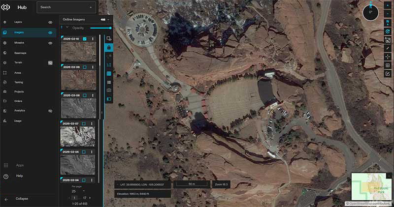
CartaVue provides access to Vantor Hub, a powerful satellite imagery subscription platform designed to deliver seamless access to multi-source, high-resolution geospatial data for mapping, simulation, and analytics applications.
Vantor Hub provides:
- Aggregated access to multiple commercial satellite imagery sources
- High-resolution imagery (up to 30 cm GSD, where available)
- Global coverage with frequent updates across key regions
- Streaming access via WMTS and WMS services for real-time visualization
- On-demand data download capabilities for offline use
- Tools for visualization, analysis, and data management
Through a satellite imagery subscription with Vantor Hub, users can:
- Access and stream imagery instantly within GIS environments
- Download imagery for local processing and integration
- Monitor areas of interest with regularly refreshed datasets
- Support applications such as simulation, mission planning, mapping, and infrastructure analysis
Vantor Hub is particularly well suited for:
- Defense and simulation programs requiring large-area coverage
- Engineering and mapping organizations needing scalable data access
- Programs that require flexibility across multiple data sources
CartaVue supports subscription setup, data access, and integration for Vantor Hub, helping customers define usage requirements, optimize costs, and ensure seamless implementation within their existing workflows.
Airbus OneAtlas Subscription Services
CartaVue also provides access to Airbus OneAtlas Living Library, a leading satellite imagery subscription platform offering global, high-resolution imagery and analytics services.
Airbus OneAtlas Living Library provides:
- Access to Pléiades and SPOT satellite imagery
- High-resolution imagery (up to 30 cm, where available)
- Global coverage with frequent revisit rates
- Streaming access via APIs, WMTS, and WMS services
- Tasking capabilities for new imagery collection
- Advanced analytics and data processing tools
Through a satellite imagery subscription with Airbus OneAtlas Living Library, users can:
- Monitor areas of interest with regularly updated imagery
- Access both archived and newly acquired data
- Integrate imagery directly into GIS and enterprise platforms
- Support applications such as defense, infrastructure monitoring, and environmental analysis
CartaVue can support integration, subscription planning, and data access for Airbus OneAtlas Living Library, ensuring customers select the most appropriate solution based on their operational and budget requirements.
Data Availability and Considerations
The availability and quality of imagery may vary depending on geographic location, frequency of satellite collection, and atmospheric conditions such as clouds, haze, and smoke.
Urban areas typically receive more frequent updates, while rural or cloud-prone regions may have fewer clear datasets available.
Flexible Subscription Pricing
CartaVue’s satellite imagery subscription pricing is based on projected usage, including streaming (view-only access) and data downloads.
Organizations can:
- Start with a lower subscription tier
- Scale usage as needed
- Refine requirements at renewal
We recommend reviewing subscriptions 30–60 days prior to renewal to ensure continuity and optimize costs.
How to Choose the Right Satellite Imagery Subscription
When evaluating a satellite imagery provider, consider:
- Coverage area
- Update frequency
- Resolution (e.g., 30 cm vs. 50 cm vs. 1 m)
- Integration with your GIS tools
- Pricing flexibility
CartaVue can help assess your requirements and recommend the most cost-effective solution.
Get Started with CartaVue
If your organization is evaluating a satellite imagery subscription, CartaVue can help you identify the right solution based on your operational needs.
Contact us at sales@cartavue.com or submit the Contact Sales form to schedule a demo or discuss your requirements.