
Services
Our role extends beyond simply locating data. We work with customers to understand project objectives, identify the most appropriate geospatial resources, evaluate available options, coordinate acquisition strategies, and deliver information formatted for operational use.
Data Sourcing & Aggregation
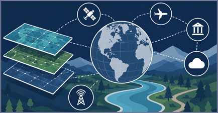
One request. Multiple providers. One seamless solution.
Access the data you need without the burden of managing multiple vendors and contracts. We source, evaluate, and aggregate information from diverse providers, delivering a unified solution tailored to your requirements. The result is broader coverage, greater flexibility, and a more efficient path from request to decision.
Accessing geospatial information often involves more than selecting a single product. Different providers offer varying levels of resolution, coverage, accuracy, archive depth, collection capabilities, licensing terms, and pricing structures.
- Archive research and availability assessments
- Historical imagery acquisition
- Multi-vendor evaluations
- Coverage analysis
- Licensing guidance
- Data aggregation
- Global data discovery
Our objective is to reduce acquisition complexity while improving access to the most appropriate commercial data available.
Accessing geospatial information often involves more than selecting a single product. Different providers offer varying levels of resolution, geographic coverage, accuracy, archive depth, collection capabilities, licensing terms, and pricing structures.
CartaVue works across a broad network of commercial providers to identify datasets aligned with project requirements. Rather than managing multiple vendors, customers can leverage a single source for evaluating options, obtaining data, and coordinating delivery.
Services include:
- Archive research and availability assessments
- Historical imagery acquisition
- Multi-vendor evaluations
- Coverage analysis
- Licensing guidance
- Data aggregation
- Global data discovery
Our objective is to reduce acquisition complexity while improving access to the most appropriate commercial data available.
Custom Data Packages
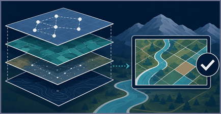
Multiple products. One integrated environment.
Bring together geospatial data, analytics, and information products into a single solution designed around your mission. We align complementary datasets to create a cohesive operating environment that supports your unique workflows and objectives. Instead of adapting your processes to fit the data, we tailor the data package to fit your needs.
Modern geospatial workflows rarely depend on a single product. Simulation environments may require imagery, elevation, vectors, and 3D models. Infrastructure programs often depend on LiDAR, orthophotography, material classification, and engineering-grade terrain products. Environmental assessments frequently combine imagery, elevation, analytics, and thematic data.
CartaVue develops coordinated data packages constructed around operational objectives rather than individual product categories.
Packages may include:
- Satellite imagery and elevation
- LiDAR and orthophotography
- SAR and optical imagery
- Material Classification and hyperspectral products
- Elevation and 3D Models
- Multi-source geospatial datasets
All components can be aligned to common geographic extents, coordinate systems, quality standards, file structures, and delivery requirements.
Tasking & Acquisition
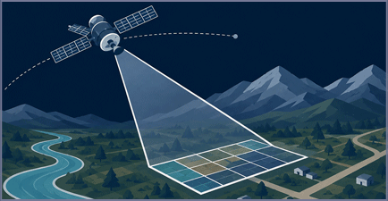
Targeted collection for mission-critical needs.
Some projects require more than what's available off the shelf or in archive. We work with a network of collection providers to acquire new imagery and geospatial data that match your timing, coverage, and quality requirements. This ensures decision-makers have access to the most relevant and current information available.
Many projects require current information that is not available through existing archives. In these situations, new acquisition activities may be necessary.
CartaVue helps evaluate collection feasibility and coordinate acquisitions across multiple sensing technologies including satellite imagery, aerial imagery, LiDAR, and other remote sensing systems.
Collection planning often requires balancing:
- Resolution requirements
- Collection timing
- Seasonal considerations
- Weather impacts
- Geographic coverage
- Operational priorities
- Budget constraints
Whether supporting a localized engineering project or a large-scale monitoring initiative, CartaVue helps customers acquire the right data at the right time.
Image Enhancement
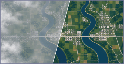
Transform source imagery into visually refined products optimized for analysis, visualization, and operational use.
We apply enhancement techniques that improve clarity, consistency, and usability while preserving the integrity of the underlying data. The result is imagery that is easier to interpret, communicate, and leverage across mission-critical workflows.
Raw imagery is not always optimized for visualization, simulation, publication, or enterprise deployment. Enhancement services can significantly improve usability and visual consistency while maintaining the integrity of the underlying source data.
Services may include:
- Color balancing
- Pan-sharpening
- Mosaic generation
- Contrast enhancement
- Artifact mitigation
- Tone correction
- Edge matching
- Visualization optimization
- Cloud Patching
These enhancements are especially valuable for simulation environments, digital twins, situational awareness applications, enterprise GIS programs, and customer-facing visualizations.
The result is imagery that is easier to interpret, more visually consistent, and better suited for operational deployment.
Data Processing & Formatting
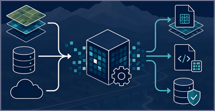
The right data. The right format. Ready to use.
Delivering geospatial information in the formats, structures, and standards required by your operational systems and workflows. We process and organize data to ensure compatibility across platforms, applications, and mission environments. The result is a streamlined integration process that reduces complexity and accelerates time to value.
Geospatial data frequently requires processing before it can be effectively integrated into operational systems.
CartaVue provides data preparation and formatting services designed to reduce customer workload and accelerate deployment.
Processing activities may include:
- Orthorectification
- Coordinate system transformation
- Reprojection
- Raster processing
- Vector processing
- Format conversion
- Metadata standardization
- Quality assurance
- Delivery preparation
The objective is to provide products that are ready for use within GIS environments, simulation systems, engineering platforms, analytical applications, and enterprise workflows.
Subscriptions
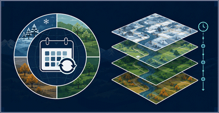
Stay current. Stay informed. Stay ahead.
Keep critical geospatial information up to date through subscription-based delivery programs customized to your areas of interest. By ensuring a steady flow of current data, we help support monitoring, planning, and operational readiness over time.
As geospatial information becomes operationally integrated across many organizations, recurring access to current information becomes increasingly important.
CartaVue supports subscription programs that provide predictable access to imagery and other geospatial products through recurring delivery models.
Subscription offerings may include:
- Satellite imagery subscriptions
- Monitoring programs
- Enterprise access agreements
- Scheduled refresh services
- Multi-user licensing
- Recurring delivery packages
- Long-term collection programs
These services help organizations move from project-based acquisitions toward sustained geospatial awareness.
Subscription models are particularly valuable for infrastructure monitoring, environmental assessment, utilities, agriculture, defense operations, public safety programs, and enterprise GIS deployments.
Need Assistance?
Not sure which geospatial products, services, or solutions best fit your requirements?
Contact our team to discuss your project objectives, area of interest, timeline, and technical needs.
We'll help identify the most appropriate options for your application.